In early 2024 we were finally able to do the trip we had initially planned in April of 2020 – that trip was cancelled for obvious reasons.
After a very long day of travelling, we arrived in Guatemala city after 9PM and went directly to the hotel to sleep. The next day, Antonio came to pick us up for a 6 hour drive to Copan Ruinas in Honduras – our first visit to Guatemala was very short! It was a good opportunity to get to know the guide who would be with us for the next 13 days.
Copan was a major settlement of the Mayas during the “Classic Mayan” Period (250 to 900 AD). It started to decline in the early 800’s and was completely abandoned by 1000 AD, probably due to the lack of drinking water.
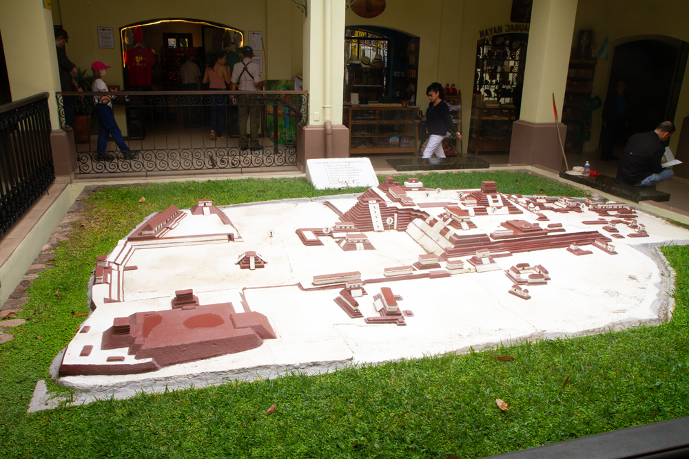
This is a model of what the main area of Copan is thought to have looked like at the height of its development. Only a few of the temples and buildings have been restored to this date for lack of funds and manpower. In the middle of the model, at numbers 2 and 3 you can see two of the highlights we will see again later.

Before we made it to the ruins, we ran into local wildlife – there were several beautiful macaws hoping for a handout.

Copan does not have the spectacular temples and buildings that Tikal can boast about. It is known for the stelae representing its successive rulers. Copan has the distinction of having been ruled by 16 members of the same family (or clan) between 400 and 825 AD. These are just two examples of these stelae that were very well described by our local guide. The front shows a portrait of the current ruler while the sides are filled with hieroglyphics about his life and times.
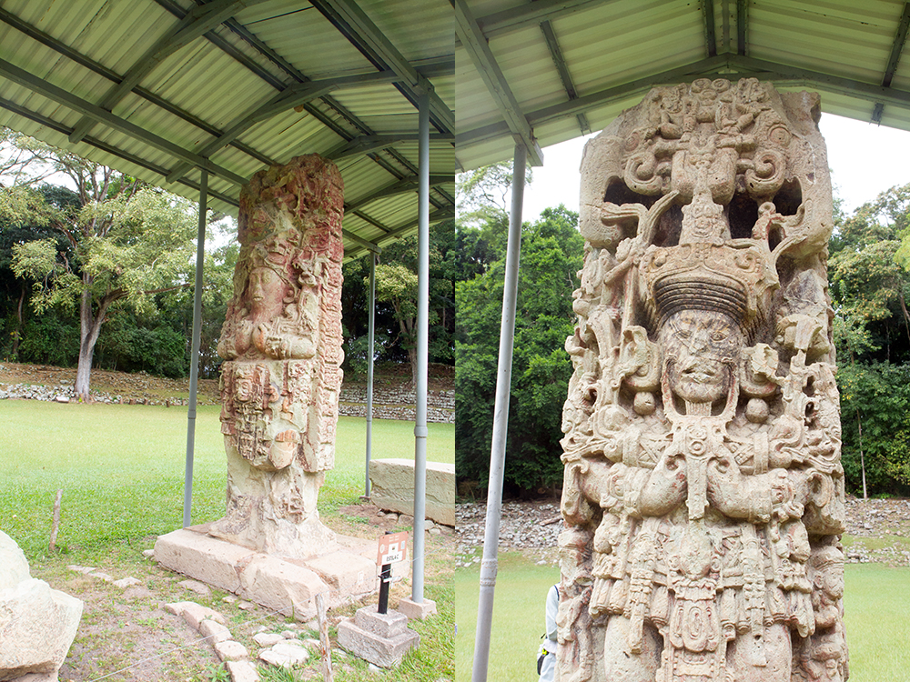
The preservation of these stelae is quite extraordinary; the one on the left still had some of the original paint on it. The quality of the carving is also unique to Copan.

There are many other sculptures that have helped archeologists to piece together the history of the site, but also the history of the Mayas as there is evidence that the various settlements did communicate with each other (and there were occasional conflicts were one clan ‘conquered’ another city) and installed their own ruler. This did not happen to Copan as was mentioned earlier. Continue reading “Guatemala – the Ancient Mayas”
(13 Page Views)