
In a short lull in the Covid19 Pandemic, we decided to go to Big Bend National Park.
We had actually booked the Chisos Mountain Lodge, in the middle of the park, for the first week in June six months earlier as this was a trip we really wanted to do. However, the lodge was still closed. We read that the Park would reopen on June 1, 2020 for day-use only so we made preparations and decided to drive there with a short stop in San Antonio on the way.
We rented a house in the Terlingua Ranch district so that we would have cooking facilities and be more independent; we also brought essentially all of own food and drinks as we read that not much was available locally. We arrived to a wonderful house on Jun 1 around 4PM and settled in.
On 2 June, we drove into the park early in the morning – we quickly found out that this was a good strategy: (1) there was no one to collect our money at the entrance gate and (2) we were ahead of whatever crowd would come in.
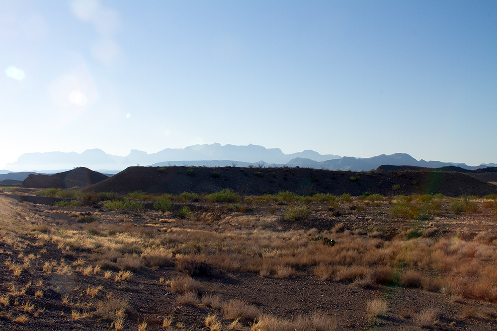
One warning – if you do not like photos of wide-open panoramas, you might as well stop right here! Big Bend is nothing if not wide open country with many different types of views, but always expansive.
As we drove into the park heading for the Santa Elena Canyon I could not resist this shot, just to prove the point above…
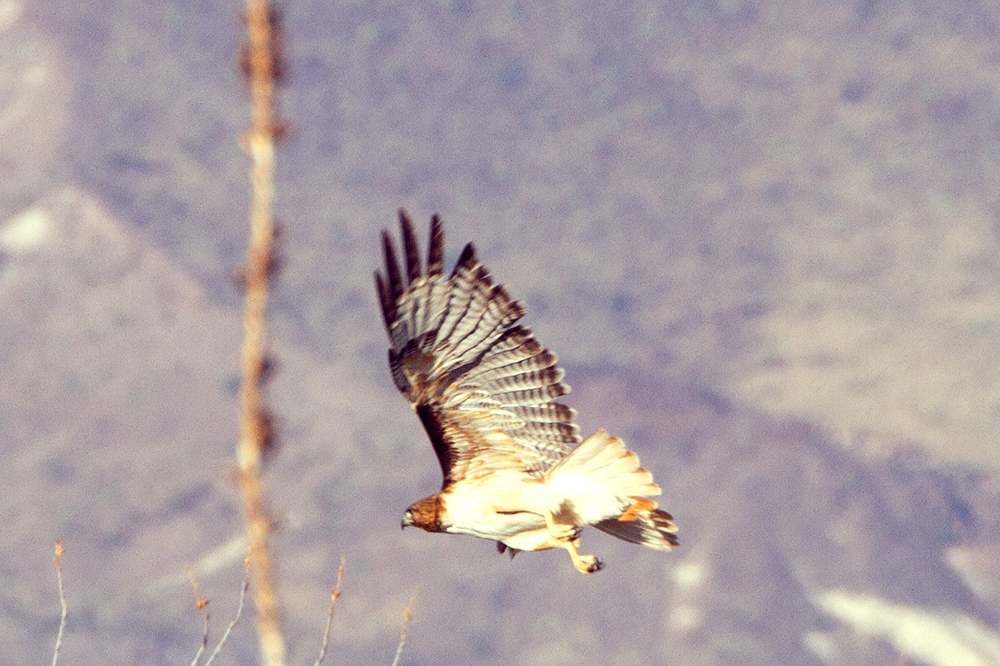
I did not drive very fast, we we were able to stop for the odd wild-life on the side of the road – this one was difficult to miss…
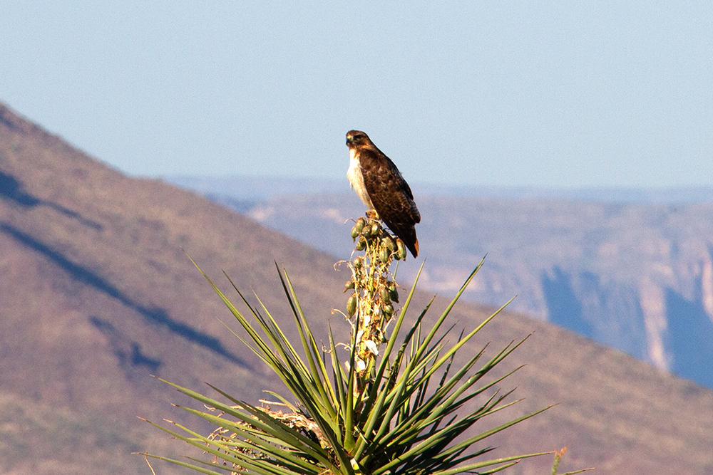
As I was photographing, he decided to fly away.
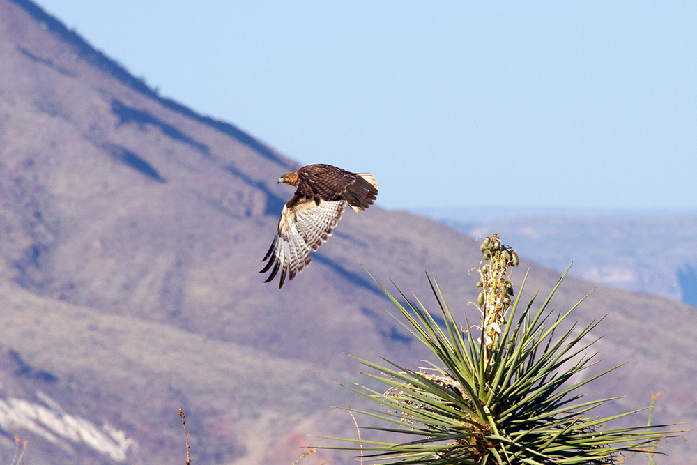
This last one is probably the best … we were so close, I hardly needed to crop this photo to make it look better.
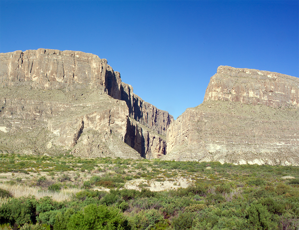
Even early morning (about 9:30) it was already hot as we prepared to explore the Santa Elena Canyon.
Here is the view as we approached the canyon. The Rio Grande makes the border between Texas (USA) and Mexico. The left side of the canyon is in Mexico.
Here is another view as we are actually entering the Canyon. The wall are almost vertical and the feeling is very eerie – there is an echo and even the river sounds different.

As we go further into the canyon, the sheer size is even more impressive. You feel so small when you are in a place like this – it took millions of years for the water to carve the rocks and we are seeing only an instant in this continuing process. There was a small group of people ahead of us who took their shoes off to continue the walk while wading into the river – we thought better and stayed on the dry shore.

Coming out of the Canyon, we get a good view of the Chisos Mountains across the desert floor. Big Bend is known for its many different landscapes in a small area (small by Texas standards…) and this is a good indication of that. We had our picnic lunch somewhere near the bend in the river, in a picnic area that was completely deserted.

After lunch we retraced our steps towards the entrance of the park stopping here and there where there was an interesting site. Not a bad view for a sandwich lunch…

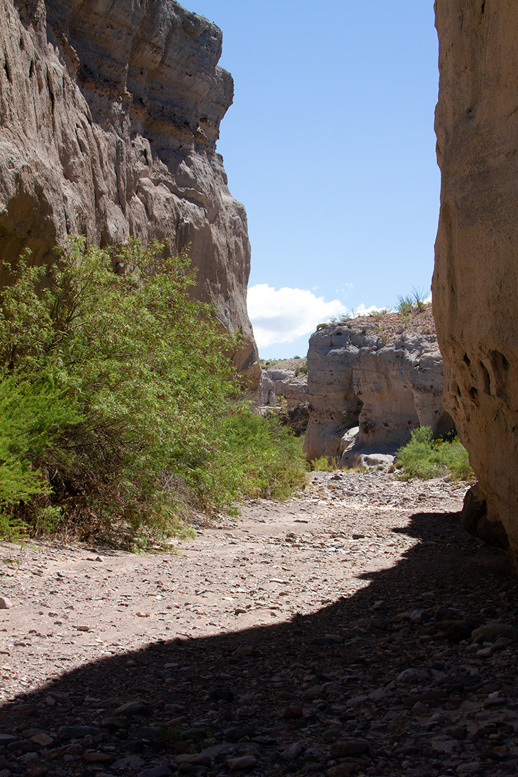
We stopped at Tuff Canyon, much smaller than the Santa Elena and completely dry. We were able to walk above and into the canyon.

I believe that this is Mule Ear Peak (Unfortunately, after the fact, it is often difficult to attach a name to a photo.

This is inside the Tuff Canyon. Not as impressive as Santa Elena but quite nice and still amazing what a little water can do.
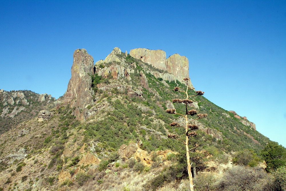
We also stopped at the Mule Ears Viewpoint for some spectacular views of the Chisos Mountains.

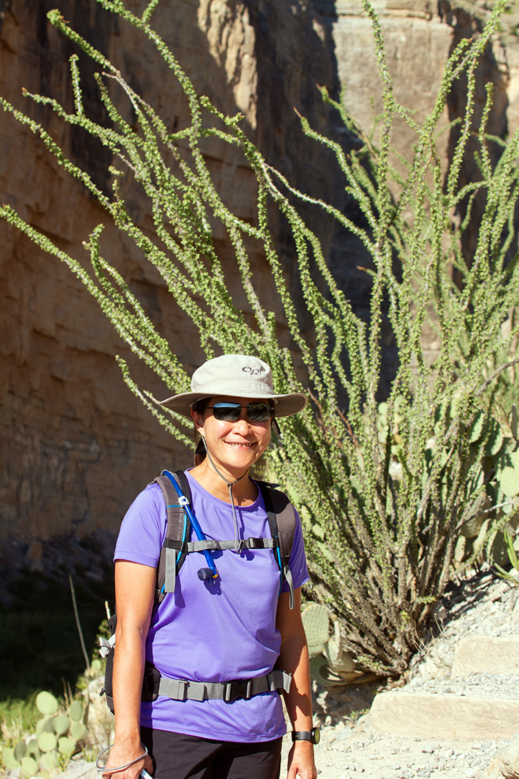
At this time of year, the temperature in the desert starts to increase rapidly in the afternoon sun. We were happy to have hats and lots of water as we were continuing our journey on the Ross Maxwell Scenic Drive.

Our last stop was the Burro Mesa Pour-off – we were not sure at all what we were likely to see here. The approach was a pleasant enough walk.

The pour-off itself was somewhat of a disappointment (not that we were really expecting a waterfall) but shows clear indication of water in the past.

On the way there, we had more wild life sightings.

In the mid-afternoon, we escaped the heat back to our air-conditioned house and watched the sunset from the comfort (almost) of the front porch. Almost comfort as the temperature was still high until the sun went completely behind the mountains.

Early morning sunrise on our second day. Today – Chisos Mountains and the main center of the Big Bend National Park..

We did one of the iconic walks in the park: The Lost Mine Trail. Here is the description from the Big Bend NP site:
Lost Mine Trail
Difficulty: Moderate; Distance: 4.8 miles round trip
Begin at mile 5.1 on the Basin Road, limited parking
This trail serves as an outstanding introduction the flora and fauna of the Chisos Mountains. With limited time, hike to marker 10 (about 1 mile), where a saddle offers stunning views of Casa Grande and Juniper Canyon. The remainder of the trail climbs steeply in and out of juniper, oak, and pine forest. The trail abruptly levels out at the ridge with superb views of Pine Canyon and the Sierra del Carmen in Mexico.
The view below is from the saddle at marker 10.
And a more general panorama from a similar spot a little further up the trail.

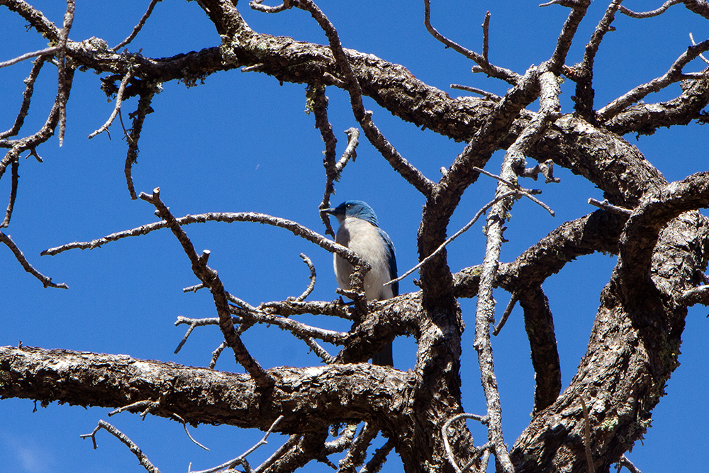
With the altitude, we saw a lot more birds on this trail.
We are nearing the end of the trail where we are going to have a quick snack. There were actually three other groups of people at the trail’s end and we kept our distance from all of them.

On the way back down. It is unfortunately not a loop and therefore the same path is used going down. However, since we are now facing the other way, we tend to have a different viewpoint.

More bird life

We had a late lunch at the Chisos Mountain Basin, one of the main centers of the Park and where the Chisos Mountains Lodge is located. We confirmed that it was indeed still closed.
In the afternoon, we took a shorter walk in the Basin and here is the description from the Big Bend NP site:
Chisos Basin Loop Trail
Difficulty:Moderate; Distance 1.8 miles round trip
Begin at the Chisos Basin Trailhead
The trail climbs gradually through shady stands of Mexican pine, oak, and juniper with many outstanding vistas of the window, and mountains surrounding the basin. Dense vegetation in the arroyos provides good habitat for bears and mountain lions; you may see tracks where they crossed the trail. Also, look for Mexican jays in the pines, and hummingbirds and Scott’s orioles in the agaves when in bloom. Though this loop trail may be done in either direction, following it counterclockwise is the easiest.
The temperature at 5400 ft was a lot more pleasant than on the desert floor and we stayed around the basin for most of the afternoon before heading back to our house.
On the way back we ran into a vulture that was a lot more interested in a dead animal that the live ones taking pictures.

We also had our first significant sighting of a road runner (significant meaning that I was able to take an actual picture before it got too far). It is the iconic animal for the park and one that brings back memories from my childhood and cartoons that were shown at the movies before the feature presentation.
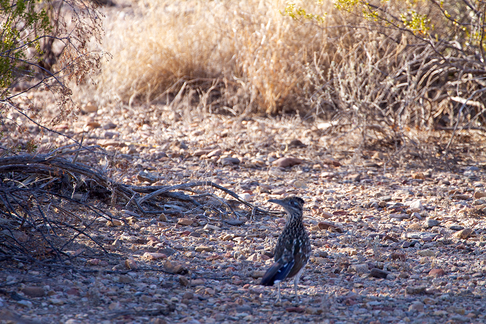
Road Runners do not fly – at least that is what I was told.
So how did this one get up there? This is a short bush but the bird is at least 12 ft off the ground since I am looking up at it. That is a significant hop, or does it climb on the limbs? We did not get an answer to all these questions.

Day three and we are heading to the Rio Grande Village. We start off with another walk that starts right from the campground called the Rio Grande Village Nature Trail. It winds around some wet ponds and has a lot of interesting wild-life. The details on the wings of this dragon fly are amazing…

It is not always the large animals that are the most interesting and photogenic…

A view of the town of Boquillas del Carmen, across the border in Mexico. There is a border crossing that would allow us to go visit, but there did not seem to be anything there to attract us.

The Rio Grande and more Mexican landscapes – at the lower right-hand corner, you can see the walkways over the ponds that we took from the campground.

Light can be a real problem when photographing a bird, especially against the sky. This is the photo only a little enhanced.
I was able to enhance further to get the bird much lighter, but this looks rather artificial, as if the bird is glowing from radio-activity or something. I continue to be amazed at what you can do with Photoshop even though now I am reduced to using Photoshop Elements as my full version of Photoshop does not work with Window 10 and they offer the software only on a monthly payment basis now… Not sure I can afford the monthly fee if I only use it once or twice a year.

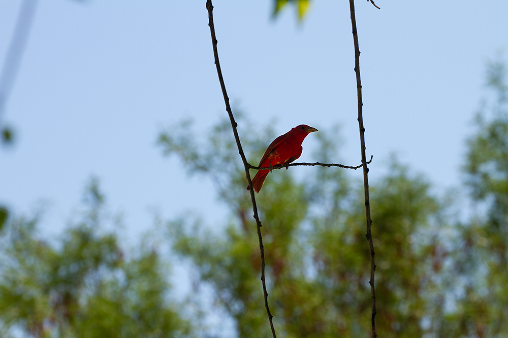
This is another red bird. I do not believe these are Cardinals but they are a very similar shade of red.

We stopped for lunch at a picnic spot at Daniel’s Ranch. We had a visitor that did not seem to mind our being there.

I was able to stay with him as he got on the parking lot. Have you seen a real road runner run?
Ready!

Set!

GO!

I really like the middle shot. If you remember the Road Runner cartoons, this is the exact position in which they would freeze the image and have an arrow pointing to the “Road Runner” with a made-up Latin name . You can get a sampling of these here: https://looneytunes.fandom.com/wiki/Latin_Names
Along the trail, we would run into displays such as this one. Each item has a price tag and there is a bottle to collect coins and bills. We suspect these are arts and crafts from the local villagers left here for sale. We never saw anybody near these displays, but we did see a group of locals on the Mexican side of the Rio Grande not too far, having lunch.

Since my first (and only previous) visit to Big Bend in 1975, there have been a few additions. Dinosaur bones were found, including an almost full pterodactyl skeleton. There is a very nice Fossil Discovery exhibit near the North entrance to the park. However, we did not stay too long as the temperature was well above 100 F and still climbing.
As I said earlier, June may not be the right month to go to Big Bend – it is a little late, but at least the crowds were smaller.

As we waited for sunset back at the house on our last evening, a family of rabbits joined.

One last sunset from Terlingua Ranch.

On our way back to Houston, we stopped first at Fort Davis. Here is a short description from their website:
A Frontier Post
Fort Davis is one of the best surviving examples of an Indian Wars’ frontier military post in the Southwest. From 1854 to 1891, Fort Davis was strategically located to protect emigrants, mail coaches, and freight wagons on the Trans-Pecos portion of the San Antonio-El Paso Road and on the Chihuahua Trail.

The site has been thoroughly restored. Here is an overhead view. The buildings on the left with the red roofs are the old Hospital.

This sign gives you an indication of how remote this was. There was nothing between San Antonio and El Paso other than a few other forts like this one.
The route was also critical for the people going to California on the Gold Rush.

These were officers’ quarters – they often came here with their whole family and were given a house to live in.

Not sure what this vulture is looking at, or looking for … It is just one of the best photos I have taken of a flying bird as the contrast is OK.

Is this an Oriole? I do not believe so, but the colors match
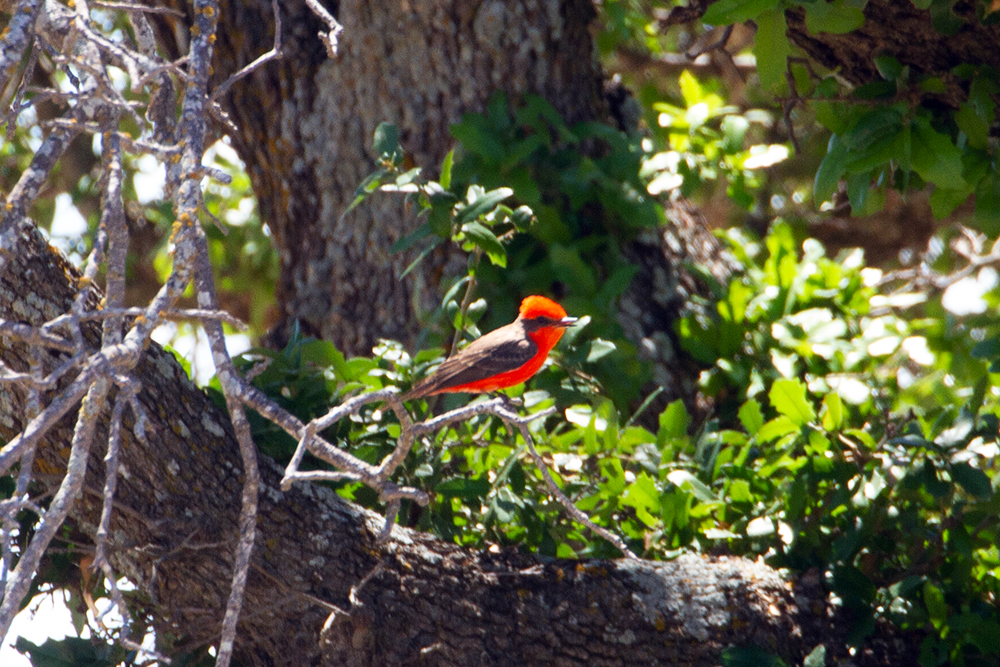
Same thing again…

As I said earlier, you have to like wide-open spaces if you come to Big Bend, so I will finish with one more panorama taken near the Fossils Discovery Exhibit.

Practical Information:
Big Bend National Park website: https://www.nps.gov/bibe/index.htm
We used VRBO to find our rental house and this is a photo of the house where we stayed called “Texas Home Sweet Home”
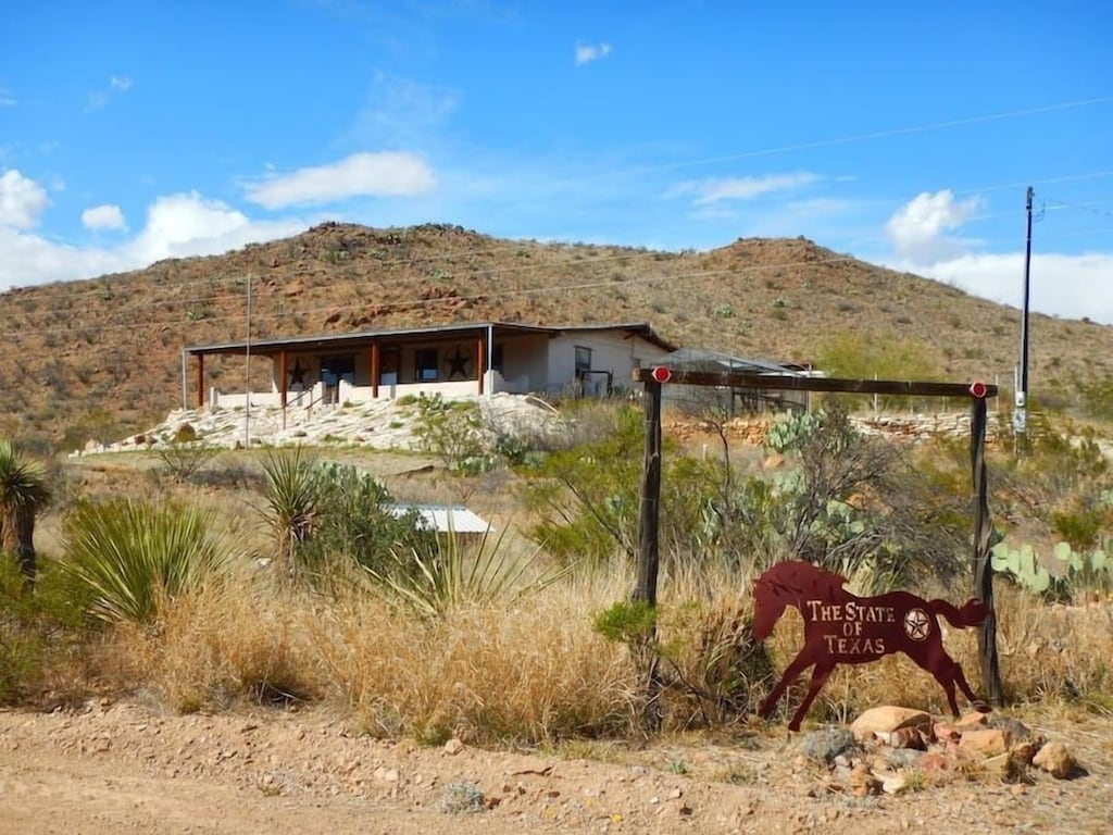
If you do not mind a 30-40 minute drive to the Park, this is a great place to stay and the house met all our expectations
Three full days in the park is a minimum to be able to see all the different environments that are present – we could have filled an extra day and if you are into serious hiking, there are many more trails that we did not get to do.
I would recommend going there between October and May – that is the high season and you have to book well in advance to find space in the Chisos Mountain Lodge. Ideal would be to geo there with a truck and large trailer so you can leave the trailer behind. You will be doing a lot of driving in the park.
(13 Page Views)
On your Big Bend trip, the red bird with the dark wings and black mask is a male Vermillion Flycatcher. Spectacular color and a good shot of him, too.