I do not know how to say this any other way. I have been in Shangri La!
I have just made the most incredible trip ever, and I am going to have a very hard time trying to help you share this with me with just a few of the most memorable sights that I was priviledged to see and just a few photos to try to make you enjoy these as I did.
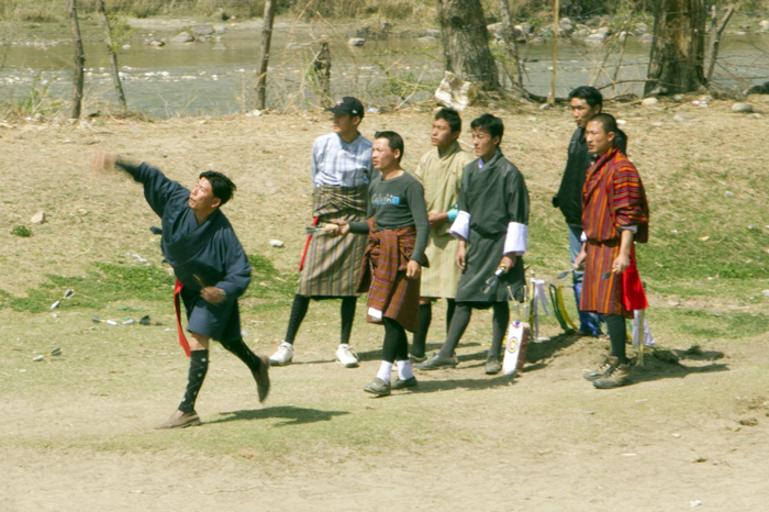
We flew from Bangkok to Dakka (in Bengladesh) and then to Paro on Druck Air – the National Airline of Bhutan which boasts a grand total of three airplanes. On the road between the airport and the town of Paro, we ran into a goup of people playing ‘darts’ – but not the pub game most of us are familiar with. The darts are much bigger and heavier and the target is smaller and much further away. As you can see from this photo, it takes quite a bit of effort to throw the dart.
Whenever a player hits the target, which you can see below, all competitors do a short celebratory dance. You can see the target behind the player in the foreground – it is on the ground with a red and blue circle – yes, that is the target. You can also see a dart in his hand.
We continued our journey into Paro where we stopped for lunch. Paro is not a large town, just two or three parallel streets and 10-15 cross streets in all. Most of the budingsarerelatively new, but they are still built in the local, very distinctive style, like this house where we had lunch.
After lunch we went to visit the National Museum which provides an excellent introduction to Bhutanese history and culture. The entrance is very impressive.
The building where it used to be housed is even more impressive. This is the old watch tower of the Paro Dzong, which is located a few meters lower down the hill. However, the building was significantly weakened by a strong earthquake that occurred in 2011 and can no longer be used for the museum.
It is very strange that I do not remember hearing about this earthquake. It was quite significant (6.8 or 6.9) but fortunately very few people died because it happened in a sparsely populated area between India and Bhutan – there was only 1 fatality in Bhutan. Unfortunately, it caused a lot of damage to many historical monuments and still now there are some that will have to be significantly rebuilt to be made safe.
It is sad, however, that the media does not seem to attach much importance to some event, just because not enough people died.
After the Museum, we indicated to our guides that we would want to stop if we saw people doing archery, the National Sport of Bhutan. All they said was OK! A little further down the road, on the way to the hotel, we did see some people practicing and asked if we could stop, and they said “not yet!”. Just a few minutes later, we arrived at the Paro Archery Ground where there was a match going on. In this case, they were using modern bows and arrows and the target was placed 150 meters away. I took two pictures only 1/8 sec apart and the arrow is already long gone in the second photo! It is nearly impossible to follow the flight of the arrow unless you are placed directly behind the shooter.
In this sport too, there is an impromptu celebration whenever a shooter hits inside the blue circle on the target – much smaller than what I am used to shoot at in ‘archery’ when I have done it a few times. They are so consistent that very few arrows miss by a wide margin and this was a particularly windy day, so I am sure they had to correct for for the strength and direction of the wind.
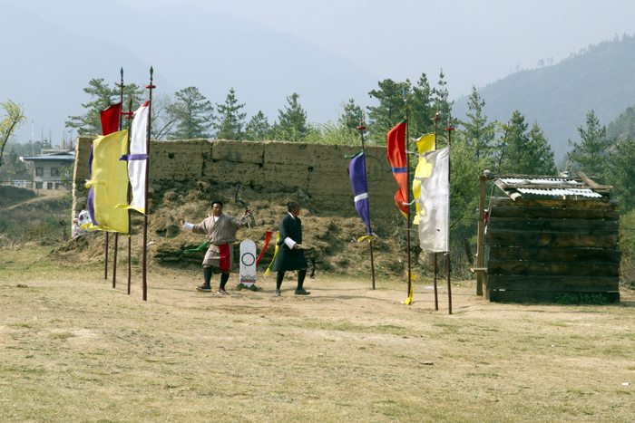
The targets and therefore the area from where the shooters aim, are surrounded by flags in the traditional colours of the prayer flags. It gives an other-worldly feel for the whole thing. Even Lebo, one of our guides, seemed to be impressed by the spectacle.
Here is what it looks like from behind the shooter. You can barely see the target at the end of the lawn – you can only see the two rows of flags and the wooden wall behind which people can hide while the shooter is aiming.
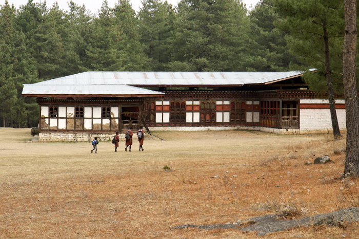
As we arrived at the hotel relatively early, we had a few hours before dinner and Bee and I decided to go explore the surrounding area. It was the end of the school day and we saw a lot of school children in their school uniform walking home. Everybody seems to be walking everywhere here. We also saw a few students getting in and out of shared taxis – I guess that is for the wealthier amongst them. These four boys happened to walk by what we initially thought looked like an old school in height order. However, now that I look at it again, maybe the orange stripe high on the wall indicates that this used to be a monastery or part of a temple building.
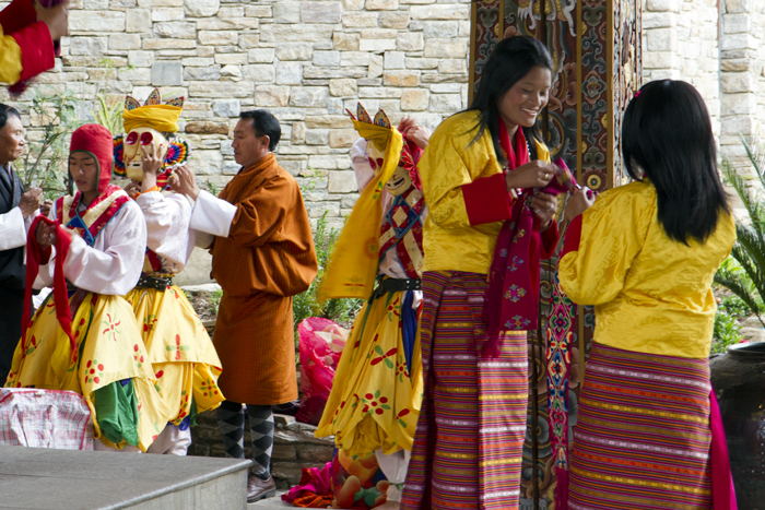
When we arrived back at the hotel, there was a ceremony getting ready for another tour group. A local troupe of artists was doing several masked dances for them. I only saw the preparations outside the hotel. I was not really interested as we would have a chance to see the real thing in only 10 more days. What did interest me is the fact that every one was smiling. They seemed to have a lot of fun doing this and getting ready for the spectacle, something that I saw often in Bhutan.
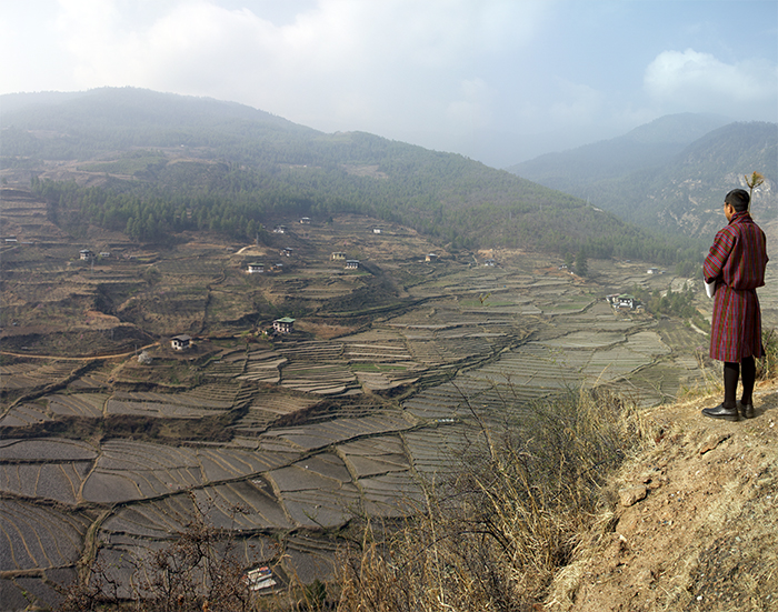
The next day, we needed to leave Paro and on our second day in Bhutan we headed towards the Ha Valley (I have seen it spelled with one and two ‘a’s so please forgive me if occasionally I switch between the two spellings). The weather is gorgeous but not very clear as there are several forest fires in the area that are making everything a bit smoky. None-the-less, we had our first panorama of rice paddies just minutes out of Paro. They are currently used to grow grain – the locals wait for the monsoon before they plant rice.
A little further up the raod, we ran into some Yaks and a group of prayer flags.
Local people will plant 108 prayer flags in the memory of a deceased family member. Sometimes these are planted near a road, more often they are planted high on the mountain as the harder it is to do, the more credit you, and the deceased, get out of the installation.
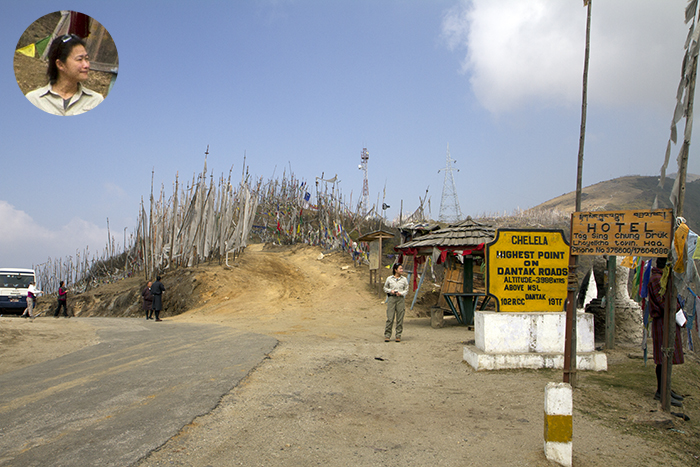
We are already well over 3500 meters and continuing to climb on the way to CheluLa, the highest tarmacked road in Bhutan at close to 4000 m. Chelu La was very much in the smoke so that we did not get great views of the valley below, just thousands of prayer flags all around us. You can see in the inset that Bee appears to be very happy about this.
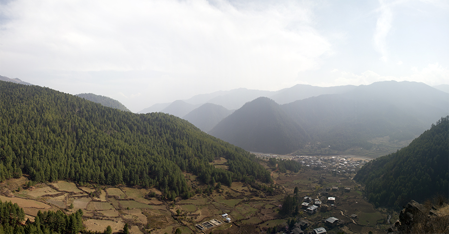
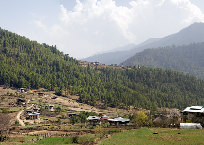
We came back down into the Ha valley, which until a few years ago was completely closed to foreigners as it was highly militarised with large Bhutanese and Indian military bases there.
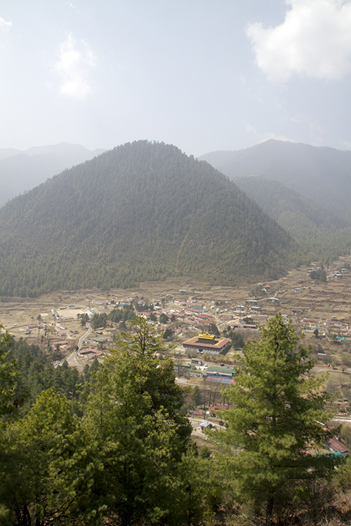
The main town of Ha is not very big and has a small Dzong; it is the square building with a yellow roof in the middle of the picture. The valley is characterised by three mounds, almost identical – one is visible here.
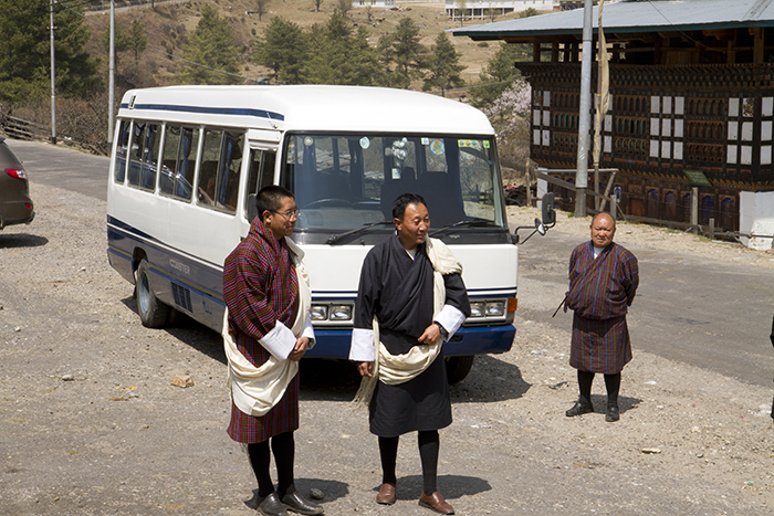
We went to visit a couple of temples as soon as we arrived. These are very important temples and monasteries and therefore our guides, Kipchu and Lebo, have donned their formal attire with the traditional kabney, or scarf, over their gho. The colour of the kabney indicates the rank of the wearer.
We are first going to visit the Temple of the White Dove or Lhakhang Karpo. The temple and monastery are being renovated (read rebuilt but in traditional style and methods) and so only the temple is left in the middle of a construction site.
As this is also a monastery, so there are monks around, including a lot of young boys being trained. What do young monks do when they have a few minutes? Play football of course. Their robes do not seem to prevent them from having a lot of fun.
We also went to visit Lhakahang Nakpo, or Temple of the Black Dove, but I did not take any good pictures of this one. Legend tells that the Tibetan King Songtsen Gampo released two doves in the 8th century, a white one and a black one, and founded the two temples where the two doves landed, hence the names. The two temples are within walking distance of each other.
After lunch, we did our first hike. Because of the altitude, we set out very slowly, but fortunately the path did not rise very fast. We are walking towards a monastery called Katsho Gompa.
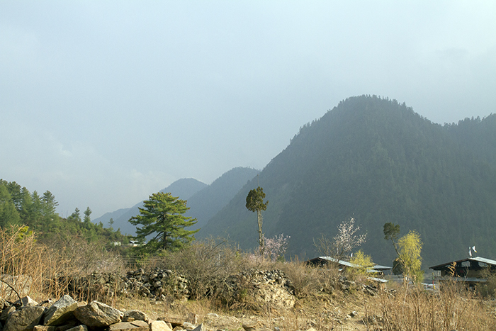
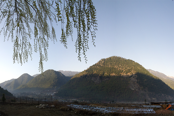
Through the haze, we also get a better view of the three hills which are the symbol of this valley. The three hills called “rigsum” represent Manjushri (the God of wisdom), Chenrezig (the Buddha of compassion) and Chana Dorji(the protector god of Bhutan). You can see them dissapearing into the haze in the middle of the photo.
We finally arrive at our destination after about 1 hour. Once you realise that it is normal to have to breathe hard, and that it is sustainable, walking is not that hard even at 3500 meters. Good lesson learned for the future.
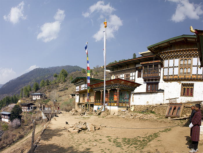
Here is a panorama of Katsho Gompa, one of the largest and most important monastery in the Ha Valley.
In a room just in front of the main temple, monks were studying in front of an open window. I remember that my uncle took several photos like this one 30 years ago and his came out better than this.
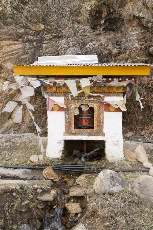
On the way back down, we saw the water-powered prayer-wheel. It is believed that one turn of the wheel is equivalent to saying all the prayers that are listed inside. There are thousand of pages with hundreds of prayers inside such a prayer wheel. Most are hand operated, but there is more efficiency in having water-powered ones.
Another view, a little clearer, of the three hills.
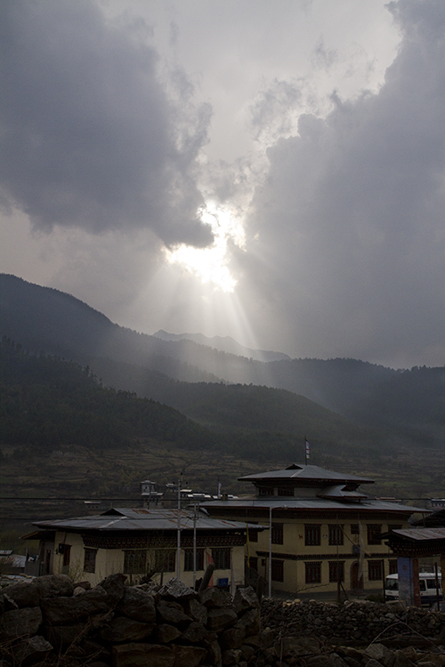
In the early evening, there is a storm brewing and we get to see spectacular skies on the way back to our guest house after a full day.
The storm did come during the night bringing some rain. This cleared up the air and gave us excellent visibility and clear skies the following morning. Here is a view of the three hills at sunrise (well, at least the time that the sun was rising over the mountains, not rising over the horizon.
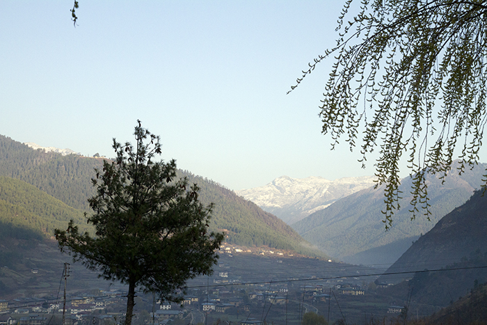
Looking up the valley, there is a clear view of the mountains that form the upper end of it. This is one of the valleys that leads to Tibet, but it is a long way in the distance, and up as well.
We go for a walk on the footsteps of Nehru. In fact, when he was prime minister of India, a few years after independence from Britain, Nehru came to Bhutan on foot, crossing from Tibet. He had been to Sikkim before that. He came to the Ha Valley and met with local officials before continuing to Paro and Thimpu. We walked up the valley, along the river, on the same historical route that he followed.
We saw some rhododendrons blooming. There are more than 40 different kinds of rhododendrons in Bhutan, some that grow into very large trees. This one was smaller and closer to the ground.
We visited a first temple in a small town than went for a hike straight up the mountain for over 1 hour. Exhausting work, but very satisfying when you get to the end of the journey and can enjoy Jamtey Gompa with a very nice structure in front of it with prayer flags. The view from up here is of course spectacular.
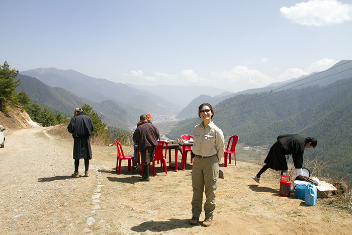
It is time for lunch and we discover that we are going to have a pic-nic on the edge of the valley, with this spectacular view in front of us. We are hungry, and very happy to dig into the excellent food.
In the afternoon, we are hiking towards Yangto Gompa. Actually, we are driven there, but need to walk back down – this is a lot easier than walking up to it.
It is time to leave Ha Valley and head towards Thimpu, the capital of Bhutan. On the way we pass by this Dzong called Dobji Dzong at the point where the Ha valley approaches the Paro Valley.
The point where the Thimpu and Paro rivers meet is called Chuzom and is a strategic location in Bhutan. This is where the main road to India departs – the first road that was built in 1960 and the only way into Bhutan for many years until the airport in Paro was built in 1984.
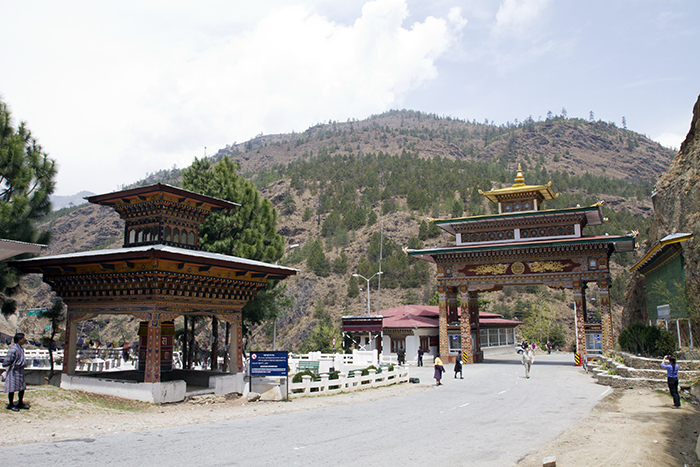
At the place where the road from India splits and can go either to Paro (on the left) or Thimpu (on the right), there is a large gateway that is also used as a emigration check point. There was a lot of police present, but I was told it was OK to take pictures.
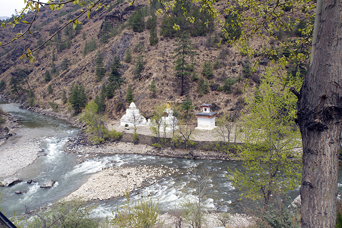
There are three Chortens across the rivers – Chortens in Bhutan are the equivalent of Stupas in Nepal and Tibet. The three Chortens have distinctive designs: the first (on the left) is the typical Nepalese design, the second is Tibetan and the third is Bhutanese. All three designs can be found in Bhutan depending on the origins of the Chorten.
I will conclude here this first episode of the trip to Bhutan. I have enough pictures and stories for probably three or four more installments – I will see as I further develop and improve the pictures I have selected.
The next episode will cover Thimpu and again Paro – not in chronological order.
(3223 Page Views)












Great info…we are planning to take the wilderness Bhutan trip march 2013. It sounds wonderful. Can you give me any insight as to what airlines you took and connections we live in Florida so could leave from LA or New York.
also how to see the rest of your blog …really enjoyed it . where did you depart from?
I cannot help with travel from US as I live in Europe.
You can find all posts on my blog at http://www.pierreo.com/blog/ and then use the navigation pane to check different months. I posted the Buthan trip in May and June.
hi.. you have done a great job. i like your post. it was very intresting going through your blog..
Thanks for Sharing about our Country(Bhutan).